Best Rail Trails in Ontario
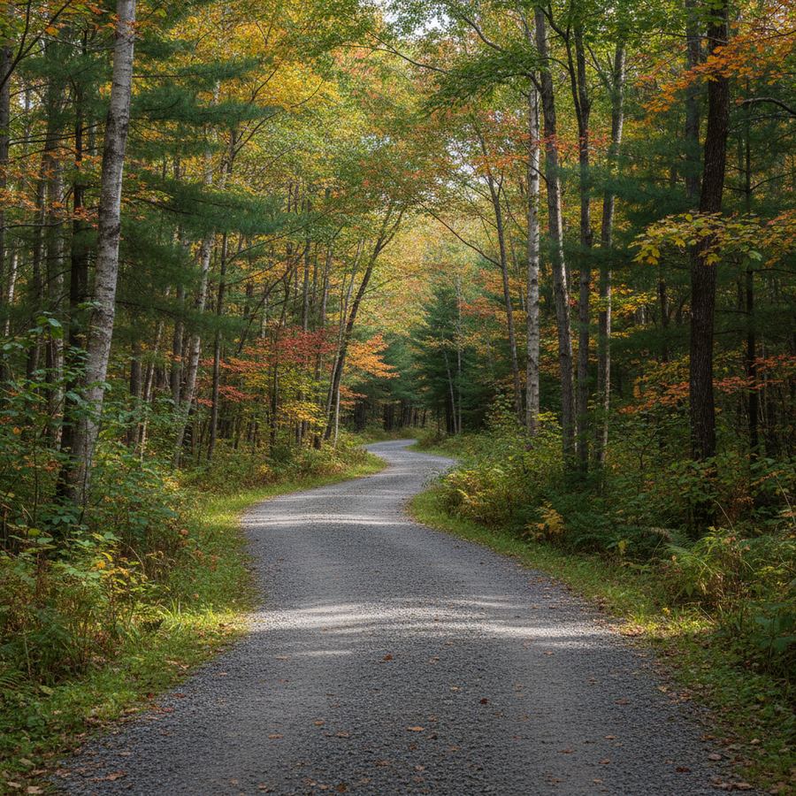
Rail trails are the backbone of recreational cycling in Ontario. Hundreds of kilometres of abandoned railway corridors have been converted into multi-use trails, and the best of them offer something no road ride can match: long, flat, car-free corridors through countryside that is otherwise hard to access on two wheels. The gentle grades that trains required mean you rarely encounter a serious hill. The crushed stone surfaces are firm enough for hybrid and gravel bikes. And the routes themselves pass through farmland, forests, and small towns that feel unchanged from the era when the trains still ran.
These ten rail trails are our picks for the best riding in the province.
1. Elora Cataract Trailway
Forks of the Credit to Elora, 47 kilometres. The Elora Cataract Trailway is the rail trail that serious gravel riders put at the top of their list. It crosses through some of the best countryside in Dufferin and Wellington counties, with rolling terrain that gives it more character than the typical flat rail trail. The eastern end starts near the Niagara Escarpment and the western end drops you in Elora, one of Ontario's most charming small towns. Crushed gravel surface, moderate difficulty, and genuinely varied scenery from forest to open farmland.
2. Bruce County Rail Trail Network
Over 100 kilometres of connected segments radiating from Owen Sound through Grey and Bruce counties. The Bruce County Rail Trail is not a single path but a network, and that is its strength. You can ride from Owen Sound south to Walkerton, southwest to Kincardine, or southeast toward Markdale, piecing together day rides or multi-day tours through the heart of the Grey-Bruce region. Crushed stone, well-maintained, and endlessly combinable.
3. North Simcoe Rail Trail
Barrie to Orillia, 30 kilometres. The North Simcoe Rail Trail is the rail trail we recommend for beginners. Flat, straight, well-surfaced crushed limestone, and easy to access from either end. The route runs through Simcoe County farmland without any technical challenges. It is not dramatic, but it is reliable and rideable for anyone who can sit on a bike. Start from the Barrie waterfront for added distance on paved path before transitioning to the rail trail.
4. Great Lakes Waterfront Trail: Rail Trail Sections
The Waterfront Trail is a mixed bag of paved paths, bike lanes, and road shoulders. But several of its segments are proper rail trails running alongside Lake Ontario or Lake Erie. The Port Colborne section along the Welland Canal, the stretches east of Cobourg through Northumberland County, and portions near Belleville all follow old rail corridors. These sections are flat, well-maintained, and offer lake views that pure inland rail trails cannot match.
5. Cataraqui Trail
Strathcona (near Kingston) to Smiths Falls, roughly 100 kilometres. This is one of Ontario's longer rail trails and a favourite with touring cyclists and bikepackers. The surface is crushed stone throughout, with some sections rougher than others. The trail passes through the granite country of the Frontenac Axis, with rock cuts, wetlands, and lake views. It is more rugged than the southern Ontario rail trails and feels wilder. Bring wider tires and carry water; services are sparse between towns.
6. Uhthoff Trail
Orillia to Coldwater, about 15 kilometres. A short trail but a pleasant one, connecting the northern end of the North Simcoe Rail Trail corridor to the town of Coldwater. The surface is crushed stone and the route passes through a mix of farmland and Shield-edge forest. Coldwater has a heritage village and a general store that has been operating since the 1800s. It works well as an extension of a North Simcoe ride for those wanting more distance.
7. Algonquin Trail
This long-distance rail trail project is still being developed, but sections between Renfrew and Barry's Bay are already rideable. When complete, it will connect multiple Ottawa Valley communities along the old railway corridor. The open sections pass through classic valley scenery: pine forests, river crossings, and views of the Ottawa River watershed. Surface quality is variable, and some sections are rougher than established trails. Adventurous riders and bikepackers will enjoy what is already available.
8. Oro-Medonte Rail Trail
A 24-kilometre crushed stone trail through the rolling countryside of Oro-Medonte Township, east of Barrie. The trail connects to the broader Simcoe County network and passes through a landscape of small farms, woodlots, and glacial hills. Less busy than the North Simcoe Rail Trail, it offers a quieter alternative for riders who prefer solitude. The terrain has a bit more roll to it than typical rail trails, reflecting the drumlin landscape of the region.
9. Hamilton to Brantford Rail Trail
About 32 kilometres of crushed stone connecting Hamilton to Brantford along the old TH&B Railway corridor. The trail passes through Dundas Valley, one of the most scenic landscapes in the Hamilton area, before straightening out through the flat farmland approaching Brantford. The Dundas Valley section has some of the best fall foliage riding near the GTA. Well-maintained and accessible from both cities.
10. Victoria Rail Trail
Lindsay to Kinmount, roughly 55 kilometres through the Kawartha Lakes region. One of Ontario's longer rail trails, it runs through a mix of farmland and Canadian Shield edge country. The northern sections near Kinmount have rock cuts and forest riding that feel more remote than the southern agricultural portions. Surface quality varies; the well-maintained sections near Lindsay are smooth, while the northern end can be rougher. It is a good option for riders looking for a full-day trail ride within a couple of hours of Toronto.
Why Rail Trails Work
The genius of rail trails is in their engineering. Railway corridors were built with gentle grades (typically under two percent), wide cleared corridors, and solid roadbeds. When converted to trails, these qualities translate to flat, well-drained, wide paths that are naturally suited to cycling. The route selection was also done well: railways followed river valleys, skirted lakeshores, and connected towns, which means rail trails tend to pass through the most interesting terrain in any region.
The limitations are surface and speed. Crushed stone is slower than pavement, and wet conditions can make it muddy or soft. A gravel or hybrid bike is the right tool for most rail trails. Road bikes work on the firmest surfaces in dry conditions but are not suitable for the majority of these trails.
Planning a Rail Trail Ride
Late May through October is the prime season for most Ontario rail trails. Spring thaw leaves many trails soft into May, and fall riding is excellent once the surface firms up in September and October. Summer weekends can be busy near major cities; weekday rides are reliably quieter.
Carry water and supplies for the distance between towns. Rail trails often pass through areas with no services for 15 to 20 kilometres. A basic repair kit (tube, pump, tire levers) is essential, since there are no bike shops in the middle of a rail trail.
For the full collection of trail options, browse the rail trails hub. The family-friendly rides page covers rail trails that work for younger riders. Trail conditions province-wide are tracked by the Ontario Trails Council, and the Ontario government cycling page has information on provincial cycling infrastructure.