Simcoe County Cycling Loop: Stayner, Creemore & Clearview Farmland
This day loop through the heart of Simcoe County covers roughly 60 to 75 kilometres of quiet back roads, passing through some of the finest cycling terrain in central Ontario. Starting and finishing in Stayner, the route heads south through the rolling farmland of Clearview Township, stops in Creemore for a well-earned break, and returns through a different set of concession roads that complete the loop. The riding is moderate, with enough rolling hills to keep things interesting but nothing that will shut down your legs. It is the kind of ride you plan around a good lunch in Creemore and a cold drink back in Stayner.
Route Overview
Start/Finish: Stayner, Ontario (park on the main street or at the community centre)
Distance: 60-75 km depending on route choices
Elevation gain: approximately 400-550 metres (rolling, no sustained climbs)
Surface: entirely paved county and township roads
Bike type: road bike, gravel bike, or hybrid
Difficulty: moderate (suitable for intermediate cyclists; strong beginners can manage with rest stops)
Stayner to Creemore: The Outbound Leg
Distance: approximately 20-25 km
Leaving Stayner
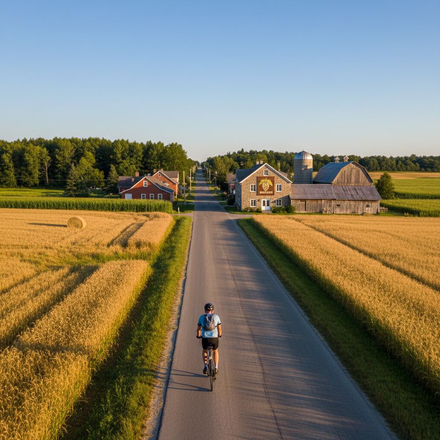
Stayner sits in the Clearview Township agricultural belt, a compact town where Highway 26 intersects with the county road grid. Start on the south side of town, picking up one of the numbered concession roads heading toward Creemore. County Road 9 South (also known as Stayner-Sunnidale Road) provides a direct route, but the quieter concession roads one grid line east or west offer better cycling with almost no traffic.
The first few kilometres south of Stayner pass through flat to gently rolling farmland. Fields of corn, soybeans, and hay stretch to the horizon, divided by tree lines and drainage ditches. The roads are paved, well-maintained, and lightly travelled. In early summer, the fields are bright green. By August, the corn stands tall enough to line the roads like walls. In September, harvest activity adds combine harvesters and grain trucks to the mix, though the concession roads remain quiet.
The Rolling Middle Section
As you ride south toward Creemore, the terrain begins to change. The flat fields give way to rolling hills as the landscape transitions toward the Niagara Escarpment. You will notice the road rising and falling more frequently, with climbs of 20 to 40 metres over distances of 500 metres to a kilometre. These are not steep enough to require grinding, but they accumulate. The scenery shifts too, with more hardwood forest, stone fences, and older farmsteads replacing the open-field agriculture further north.
Watch for the views westward toward the Mad River valley and the escarpment beyond. On clear days, the forested ridge of the escarpment is visible as a dark line on the horizon. The back roads through here carry minimal traffic and are some of the most satisfying cycling roads in the province.
Arriving in Creemore
Creemore appears in a shallow valley, its church steeples and the brewery's grain elevator visible before you reach town. The village has a population of roughly 1,300, but its charm punches well above its weight. The main street is lined with heritage buildings housing an art gallery, a bookshop, cafes, and specialty food stores. Creemore Springs Brewery, housed in a converted hardware store, is the town's most famous attraction. Brewery tours are available, and the retail store sells bottles and growlers. For cyclists, this is the natural halfway point and lunch stop.
Lunch options: Creemore has several good spots. The Creemore Kitchen offers locally sourced meals. The bakery on Mill Street does excellent sandwiches and baked goods. If you are timing the ride around lunch, aim to arrive between 11:30 and noon to beat any weekend crowds at the more popular restaurants.
Creemore to Stayner: The Return Loop
Distance: approximately 35-45 km
The Eastern Return
Rather than retracing your route, loop back to Stayner via a different set of roads to the east. Head east from Creemore on County Road 9 toward Glencairn, a crossroads community about 8 kilometres from town. From Glencairn, turn north onto the concession roads that run through the heart of Clearview Township. This eastern return route passes through a slightly different landscape: broader fields, fewer trees, and a flatter profile than the roads west of Creemore.
The riding through this section is relaxed and rhythmic. The roads are straight or gently curving, the grades are mild, and the views are open. You can see weather approaching from kilometres away, which is useful information on summer afternoons when thunderstorms can build quickly. This is the section where you settle into a pace and let your mind wander while the kilometres pass under your wheels.
The Nottawasaga River Crossing
Depending on your exact routing, you may cross the Nottawasaga River, which winds through the township on its way to Georgian Bay. The river valley is flat and sometimes swampy, with cattail marshes and the occasional heron standing in the shallows. Bridge crossings offer a good excuse to stop and stretch. The roads near the river can be slightly rougher than the main concessions, with older pavement and occasional gravel shoulders. Nothing impassable, but worth noting if you are on narrow tires.
Northern Approach to Stayner
The final stretch into Stayner from the south and east brings you through the agricultural fringe of town. The roads flatten out as you approach, and the grain elevators and water tower mark your destination. Arriving back in Stayner after a full loop through the countryside carries a quiet satisfaction. The town's main street has a few spots where you can sit with a cold drink and decompress.
Route Variations
Shorter Loop (40-45 km)
For a shorter ride, head directly to Creemore via County Road 9 and return the same way. This cuts the distance but misses the variety of the eastern loop. Alternatively, cut the eastern loop short by turning north earlier, bypassing Glencairn and reducing the overall distance by 10 to 15 kilometres.
Extended Escarpment Option (85-95 km)
For a longer, harder ride, continue south and west from Creemore toward Singhampton and the escarpment. The climb up to the escarpment edge adds 100 metres of elevation in about 3 kilometres and rewards with panoramic views over the lowland. Return via Duntroon and the roads north to Stayner. This variation adds genuine hill climbing and another 20 kilometres to the day. It is best suited to fit riders comfortable with sustained efforts.
Practical Information
- Parking: Free street parking in Stayner on the main street and at the community centre.
- Water: Fill bottles in Stayner before departure. Creemore has public water at the park. There are no reliable water sources on the rural road sections between towns.
- Cell service: Generally reliable throughout the loop, though some low-lying areas near the river may have weak signal.
- Road conditions: Paved throughout on the main route. Some concession roads have rougher chip seal surfaces. Check for construction, which can close rural roads with little advance notice in summer.
- Traffic: Minimal on concession roads. County Road 9 carries moderate traffic. Weekday mornings are the quietest times. Weekend mornings are also good. Avoid Friday and Sunday afternoons when cottage traffic passes through the area.
- Best season: June through October. September is ideal for this loop, with harvest colours in the fields and comfortable riding temperatures. The Clearview Township trails page lists local trail conditions and events.
This loop captures the essence of what makes Simcoe County cycling so rewarding: honest roads through beautiful farmland, a genuine small-town stop at the turnaround, and the kind of riding that reminds you why you got on a bike in the first place.