Georgian Bay Cycling Trip: Weekend on the Georgian Trail & Tay Shore Trail
This weekend itinerary combines the two best cycling trails on Georgian Bay's southern shore into a satisfying two-day trip. Day 1 covers the Georgian Trail from Collingwood to Meaford and back, riding through apple orchards and along the bay. Day 2 shifts east to explore the Tay Shore Trail and the waterfront paths connecting Penetanguishene and Midland. Together, the two days offer roughly 100 to 120 kilometres of riding on dedicated trails and quiet roads, with plenty of stops for food, swimming, and taking in the views.
Day 1: The Georgian Trail (Collingwood to Meaford)
Distance: 55-68 km (round trip or one-way with shuttle) | Surface: packed limestone and paved sections
Morning: Collingwood Departure
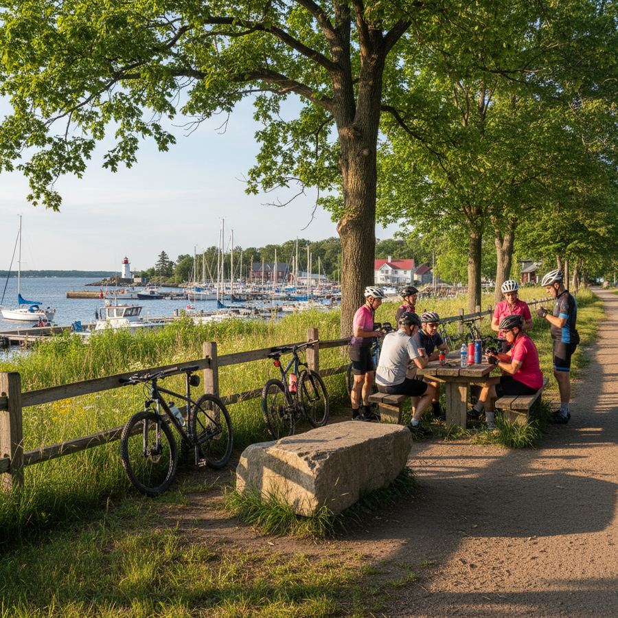
Start in Collingwood, where the Georgian Trail begins near the harbour and grain terminal area on the east side of town. Park at the trailhead or at the public lot near the waterfront. Several cafes on Hurontario Street, Collingwood's main drag, provide excellent pre-ride fuel. The Collingwood Bike Co-op and other local shops can handle last-minute repairs or rentals if needed.
The Georgian Trail heads west from Collingwood along the Georgian Bay shoreline. The first few kilometres pass through the edge of town before the trail opens into a corridor of farmland and orchards. The surface alternates between packed crushed limestone and paved sections, all of it well-maintained and suitable for any bike with tires 25mm or wider. The grade is almost perfectly flat, following the former railway bed that once connected the bay's port towns.
Mid-Morning: Thornbury
After approximately 15 kilometres, you reach Thornbury. The trail runs right through town, crossing the Beaver River near the harbour. Thornbury is worth a genuine stop, not just a roll-through. The town has an excellent bakery (Thornbury Bakery Cafe has been a cyclist favourite for years), a farmers' market on Saturday mornings, and a harbourfront park where you can sit on the dock and watch the bay. The Beaver River valley, visible from the trail bridge, is particularly striking in autumn when the maples along the banks turn colour.
West of Thornbury, the trail continues through apple orchard country. This is one of Ontario's primary apple-growing regions, and in September the trees are heavy with fruit. Several orchards along the route operate farm stands where you can pick up a bag of apples or fresh cider for the ride.
Midday: Meaford
The trail ends in Meaford, approximately 34 kilometres from Collingwood. Meaford is a quiet town with a deep harbour and a pace that suits a leisurely lunch stop. The harbour area has picnic tables and views across the bay. Restaurants on Sykes Street North offer sit-down meals. The Meaford farmers' market operates on Saturday mornings and is one of the better markets in the region.
From Meaford, you have options. The simplest is to turn around and ride the trail back to Collingwood, giving you a 68-kilometre round trip. If you prefer a loop, county roads south of the trail provide alternative routing through the farmland between Meaford and Collingwood. These roads are paved, carry light traffic, and add some gentle hills that the flat trail avoids. A loop via County Road 7 and Poplar Sideroad covers roughly the same distance as the return trail ride but with more varied terrain.
Afternoon: Return and Evening
Back in Collingwood, the town's restaurant and brewery scene provides ample options for a post-ride dinner. The Collingwood Brewery on Balsam Street is a popular spot. For accommodation, Collingwood has hotels, B&Bs, and vacation rentals at a range of price points. Booking ahead is recommended for summer weekends, particularly in July and August when the area draws heavy tourist traffic.
Overnight in Collingwood: Downtown hotels put you within walking distance of restaurants and the trailhead. If you prefer something quieter, B&Bs in the Thornbury area are also an option, and they place you mid-trail for an easy morning start.
Day 2: Tay Shore Trail and Penetanguishene-Midland Waterfront
Distance: 40-55 km | Surface: packed gravel, paved waterfront paths, and quiet roads
Getting to the Eastern Bay
Day 2 requires a drive east from Collingwood to the Penetanguishene-Midland area, roughly 45 minutes by car via Highway 26 and County Road 93. If you are travelling with a group, consider carpooling and parking in Penetanguishene, where the waterfront has free public parking. An alternative is to base yourself in the Midland area for the entire weekend and drive west to Collingwood for Day 1.
Morning: Penetanguishene Waterfront
Begin at the Penetanguishene waterfront, where a paved path runs along the harbour and connects south toward Midland. The waterfront area in Penetanguishene is well-developed, with parks, public docks, and views across the sheltered inlet. The path passes the historic naval and military establishments, including Discovery Harbour, where British and French military history shaped this community. It is worth locking the bike and walking through if you have an interest in Canadian history.
The path connecting Penetanguishene to Midland covers approximately 8 kilometres through residential areas and parkland. It is paved and flat, suitable for all bike types and ability levels. Midland's waterfront area includes the large murals that the town is known for, painted on buildings throughout the downtown core. A cafe stop in Midland before heading onto the Tay Shore Trail sets you up well for the rest of the day.
Late Morning and Afternoon: Tay Shore Trail
The Tay Shore Trail begins in the Midland-Penetanguishene area and follows the shoreline of Tay Township along Georgian Bay. The surface is packed gravel and crushed stone, well-suited to hybrid and gravel bikes. The trail passes through stretches of mixed forest, offering shade on hot days, and opens up at intervals to reveal views across the bay. The pace on the Tay Shore Trail tends to be more relaxed than on the Georgian Trail, with fewer users and a more natural, ungroomed feel.
Several access points along the trail connect to local roads, allowing you to build loops of varying length. A basic out-and-back on the trail from Midland covers 20 to 30 kilometres, depending on your turnaround point. Adding a road loop through the farmland south of Tay Township extends the ride to 40 or 50 kilometres and introduces some gentle rolling terrain.
Afternoon: Wrap-Up
Finish back in Penetanguishene or Midland for a late lunch. Both towns have waterfront restaurants where you can sit with a view of the bay and reflect on two days of excellent riding. If you have energy remaining, the roads around the Wye Marsh Wildlife Centre, just east of Midland, offer a flat, scenic loop of about 15 kilometres through wetland habitat.
Logistics and Tips
- Total weekend distance: 100-120 km across both days, with options to extend or shorten.
- Bike recommendation: A gravel bike or hybrid handles both trails well. Road bikes with 28mm+ tires work on the Georgian Trail but may struggle on the Tay Shore Trail's rougher sections.
- Driving between days: The two trail systems are not connected by a direct cycling route, so driving between Collingwood and Penetanguishene on Day 2 morning is the practical approach. The drive is roughly 45 minutes.
- Water and food: Both trail systems pass through or near towns with services. The Georgian Trail has Thornbury at the midpoint. The Tay Shore Trail is closer to town throughout. Carry one or two bottles and a snack.
- Best time: June through October. September is the standout month, with apple harvest season on the Georgian Trail, comfortable riding temperatures, and the first hints of fall colour. The Simcoe County trails page provides current trail conditions.
For a broader overview of cycling opportunities in this area, see the full Georgian Bay cycling guide.